-
Recent Searches
Recent Searches
- Travel Alerts
- My Account
- Customer Service
-
United Kingdom
 Checkout with PayPal
 Rated FEEFOERR:System.NullReferenceException: Object reference not set to an instance of an object.
at DirectFerries.WebTemplate.Core.Feefo.get_Results()
at DirectFerriesResp.Web.USPBar.GetFeefoRating()% by over FEEFOERR:System.NullReferenceException: Object reference not set to an instance of an object.
at DirectFerries.WebTemplate.Core.Feefo.get_Results()
at DirectFerriesResp.Web.USPBar.GetFeefoTotal() customers
Highly Rated
Rated FEEFOERR:System.NullReferenceException: Object reference not set to an instance of an object.
at DirectFerries.WebTemplate.Core.Feefo.get_Results()
at DirectFerriesResp.Web.USPBar.GetFeefoRating()% by over FEEFOERR:System.NullReferenceException: Object reference not set to an instance of an object.
at DirectFerries.WebTemplate.Core.Feefo.get_Results()
at DirectFerriesResp.Web.USPBar.GetFeefoTotal() customers
Highly Rated
 Our customers rate us FEEFOERR:System.NullReferenceException: Object reference not set to an instance of an object.
at DirectFerries.WebTemplate.Core.Feefo.get_Results()
at DirectFerriesResp.Web.USPBar.GetFeefoScore()/5 based on the independent review site
Our customers rate us FEEFOERR:System.NullReferenceException: Object reference not set to an instance of an object.
at DirectFerries.WebTemplate.Core.Feefo.get_Results()
at DirectFerriesResp.Web.USPBar.GetFeefoScore()/5 based on the independent review site
 Over 1 million prices checked daily
Great Deals
Over 1 million prices checked daily
Great Deals We're dedicated to saving you money. We check over 1 million prices every day to ensure to ensure we get you a great deal!
 Trusted by over 2.5 million customers
TrustedOur service is secure and easy to use, it's no wonder over 2,500,000 customers have put their trust in us
Trusted by over 2.5 million customers
TrustedOur service is secure and easy to use, it's no wonder over 2,500,000 customers have put their trust in us
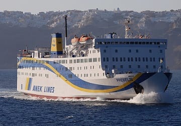
Sitia to Diafani Ferry
The Sitia Diafani ferry route connects Crete with Dodecanese Islands. Currently there is just the 1 ferry company operating this ferry service, Anek Lines. The crossing operates up to 2 times each week with sailing durations from around 6 hours 10 minutes.
Sitia Diafani sailing durations and frequency may vary from season to season so we’d advise doing a live check to get the most up to date information.
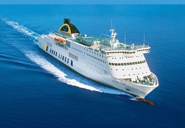
Sitia - Diafani Ferry Operators
-

- 2 Sailings Weekly 6 hr 10 min
- Get price
Average Sitia Diafani Prices
Prices shown represent the average one way price paid by our customers. The most common booking on the Sitia Diafani route is a car and 2 passengers.
Sitia Guide
The port town of Sita is located on the Greek island of Crete which lies in the Aegean Sea. On the island, Sita is to the east of Agios Nikolaos and to the north east of Lerapetra. The town is generally not much visited by tourists and is not particularly well developed and can trace its history back to Minoan times. Excavations have been unearthed in the neighbouring site of Petras which date back to the end of the Neolithic period, 3,000 BC through to the Bronze Age, 3,000 - 1,050 BC. In support of the Petras findings, excavations at other archaeological sites on the island, such as Itanos and Mochlos, have found artefacts from Minoan times. Petras has, over its history, also been under the control of the Venetians who used it as a base for their eastern Mediterranean operations. The site was destroyed by an earthquake in 1508, and again by pirates in 1538 and by the Venetians in 1651.
The port at Sitia connects Sitia and eastern Crete with several other Greek islands as well as with the port of Piraeus on the Greek mainland. The town also has a marina which accommodates smaller fishing boats and yachts.
Diafani Guide
The Greek town and port of Diafani is located on the island of Karpathos which is located in the southern part of the Dodecanese group of islands, between the islands of Crete and Rhodes. As the second largest of the Dodecanese islands, Karpathos extends to a surface area of around 300 sq. km and its terrain is characterised by mountains, the highest peak being Kali Limni and 1,214 meters above sea level. On the slopes of the mountains are springs, vineyards, forests of Pine, olive trees and many other varieties of fruit trees. A popular tourist site on the island are the rock caves that are home to the Mediterranean seal which can is supposedly the only place they can be found along with Kastelorizo. The island's first inhabitant, according to mythology, was Iapetos, the son of Uranus and Gaea (Sky and Earth).
The island can trace its history back to the Neolithic Age and is closely linked with the history of Rhodes and the other islands of the Dodecanese. The island's character has been strongly influenced by those who have conquered it including the Francs, the Turks and the Italians.